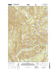
2014 Map of Wahtum Lake
USGS Topo · Published 2014About this map
Wahtum Lake serves as a central hub for the wilderness recreation network within the Mount Hood National Forest, situated along the dramatic boundary of Hood River and Multnomah Counties. This high-elevation terrain is defined by its glacial and volcanic landforms, including the prominent Chinidere Mtn and Tomlike Mtn. A significant stretch of the Pacific Crest National Scenic Trail traverses the landscape, passing by Indian Springs and winding through the Benson Plateau as it navigates the ridge lines.
Find a feature on this map
51 named features on this map. Tap any name to fly to it.
Don’t see what you’re looking for? This feature index may not catch every label — zoom into the map to look around manually.
Map Details
Editions of this 2014 Wahtum Lake Map
This is the sole edition of this map. No revisions or reprints were ever made.
Other maps of this area

1924 · Mount Hood
USGS Topo · 1:125,000

1926 · Hood River
USGS Topo · 1:125,000

1927 · Mount Hood
USGS Topo · 1:125,000

1929 · Hood River
USGS Topo · 1:125,000

1953 · The Dalles
USGS Topo · 1:250,000

1956 · The Dalles
USGS Topo · 1:250,000

1957 · The Dalles
USGS Topo · 1:250,000

1957 · Bonneville Dam
USGS Topo · 1:62,500

1957 · Hood River
USGS Topo · 1:62,500
1962 · Hickman Butte
USGS Topo · 1:24,000