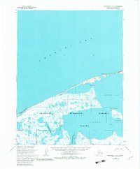
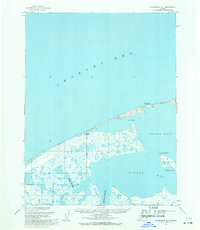
1955 Map of Wainwright D-1
USGS Topo · Published 1982About this map
Chukchi Sea coastline and the vast waters of Peard Bay dominate this mid-century survey of the North Slope. The landscape is defined by the National Petroleum Reserve in Alaska, a massive tract established to secure energy resources, which encompasses the winding courses of the Igklo River and Kogrua River. Coastal activity is centered around established sites such as Atanik and Pingasagruk, where the shoreline meets the Arctic waters.
Find a feature on this map
15 named features on this map. Tap any name to fly to it.
Don’t see what you’re looking for? This feature index may not catch every label — zoom into the map to look around manually.
Map Details
Editions of this 1955 Wainwright D-1 Map
3 editions found
Other maps of this area

1951 · Meade River
USGS Topo · 1:250,000

1951 · Wainwright
USGS Topo · 1:250,000

1955 · Wainwright
USGS Topo · 1:250,000

1955 · Meade River
USGS Topo · 1:250,000

1955 · Wainwright C-1
USGS Topo · 1:63,360

1955 · Meade River D-5
USGS Topo · 1:63,360

1955 · Meade River C-5
USGS Topo · 1:63,360
1955 · Wainwright D-2
USGS Topo · 1:63,360
1955 · Wainwright C-2
USGS Topo · 1:63,360
1955 · Wainwright D-1
USGS Topo · 1:63,360