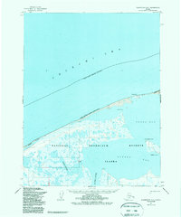
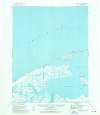
1955 Map of Wainwright D-1
USGS Topo · Published 1988About this map
The Chukchi Sea coastline in the mid-1950s reveals a landscape of isolated seasonal settlements and sprawling wetlands between Peard Bay and Kugrua Bay. This Arctic environment, characterized by the low-lying reaches of the Igklo River and Kugrua River, is defined by its transition from the Alaska Maritime National Wildlife Refuge into the expansive National Petroleum Reserve in Alaska. Small outposts like Atanik and Pingasagruk sit along the narrow coastal barrier, while the inland terrain is a maze of lakes and marshes typical of the North Slope. A solitary Winter Trail provides the only mapped overland connection through the coastal refuge, tracing the edge of the sea. The map also identifies maritime hazards such as a Possible shoal (1955) near Eluksingiak Point, reflecting the ongoing challenges of Arctic navigation during this era of exploration.
Find a feature on this map
16 named features on this map. Tap any name to fly to it.
Don’t see what you’re looking for? This feature index may not catch every label — zoom into the map to look around manually.
Map Details
Editions of this 1955 Wainwright D-1 Map
3 editions found
Other maps of this area

1951 · Meade River
USGS Topo · 1:250,000

1951 · Wainwright
USGS Topo · 1:250,000

1955 · Wainwright
USGS Topo · 1:250,000

1955 · Meade River
USGS Topo · 1:250,000

1955 · Wainwright C-1
USGS Topo · 1:63,360

1955 · Meade River D-5
USGS Topo · 1:63,360

1955 · Meade River C-5
USGS Topo · 1:63,360
1955 · Wainwright D-2
USGS Topo · 1:63,360
1955 · Wainwright C-2
USGS Topo · 1:63,360
1955 · Wainwright D-1
USGS Topo · 1:63,360