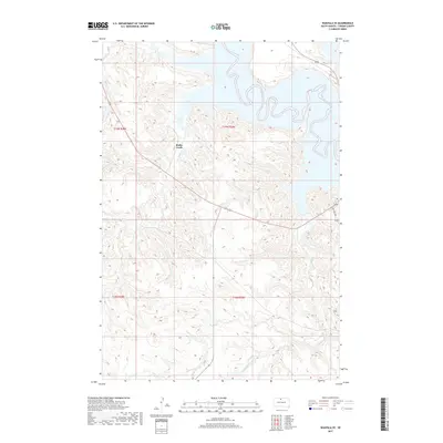
2017 Map of Wakpala SE
USGS Topo · Published 2017About this map
Snake Creek and its tributary Snake Cr meander through the deeply dissected terrain of Corson County, carving intricate drainage patterns into the Missouri River breaks. The landscape on this 2017 survey is defined by these sharp relief changes, where high bluffs overlook the water's edge. Transport through this rugged topography is anchored by State Hwy 1806, which skirts the eastern edge of the quadrangle, following the general path of the river. Further south, Claymore Cr cuts through the southeastern corner of the map, illustrating the persistent erosion that shapes the Standing Rock Reservation area. The map primarily documents natural water systems and the established road network without the dense concentration of named settlements found in more developed regions.
Find a feature on this map
8 named features on this map. Tap any name to fly to it.
Don’t see what you’re looking for? This feature index may not catch every label — zoom into the map to look around manually.
Map Details
Editions of this 2017 Wakpala SE Map
This is the sole edition of this map. No revisions or reprints were ever made.
Other maps of this area

1953 · McIntosh
USGS Topo · 1:250,000

1956 · Wakpala NW
USGS Topo · 1:24,000

1956 · Wakpala SE
USGS Topo · 1:24,000

1956 · Wakpala SW
USGS Topo · 1:24,000

1956 · Wakpala
USGS Topo · 1:24,000

1958 · McIntosh
USGS Topo · 1:250,000

1967 · Mobridge NW
USGS Topo · 1:24,000

1967 · Mobridge
USGS Topo · 1:24,000

1968 · Moreau NW
USGS Topo · 1:24,000

1975 · Laundreaux Butte
USGS Topo · 1:24,000