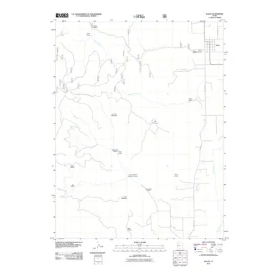
2011 Map of Wales
USGS Topo · Published 2011About this map
The town of Wales sits on the eastern edge of the San Pitch Mountains, overlooking a drainage network that feeds the San Pitch River. This 2011 survey documents the transition from the high ridges of Big Mountain and Horse Mountain down to the valley floor, where the landscape is carved by deep geographic features such as Wales Canyon, Petes Canyon, and Coal Canyon. The settlement pattern follows the base of the mountains, with Wales Cemetery and residential streets like W 100 S marking the established local community. Water management is central to the area's geography, evidenced by Reservoir Rd and the various forks and creeks, including Chicken Creek and Peach Canyon Creek, which navigate the steep descent from the peaks into the agricultural valley below.
Find a feature on this map
25 named features on this map. Tap any name to fly to it.
Don’t see what you’re looking for? This feature index may not catch every label — zoom into the map to look around manually.
Map Details
Editions of this 2011 Wales Map
This is the sole edition of this map. No revisions or reprints were ever made.
Other maps of this area

1885 · Manti
USGS Topo · 1:250,000

1895 · Manti
USGS Topo · 1:250,000

1951 · Moroni
USGS Topo · 1:62,500

1951 · Nephi
USGS Topo · 1:62,500

1956 · Price
USGS Topo · 1:250,000

1960 · Price
USGS Topo · 1:250,000

1962 · Price
USGS Topo · 1:250,000

1965 · Chriss Canyon
USGS Topo · 1:24,000

1965 · Hells Kitchen Canyon SE
USGS Topo · 1:24,000

1965 · Manti
USGS Topo · 1:24,000