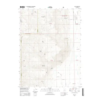
2014 Map of Wales
USGS Topo · Published 2014About this map
Wales sits at the edge of the Sanpete Valley, where the flat agricultural plains meet the steep ascent of the San Pitch Mountains. This landscape is defined by the sharp transition from the irrigated valley floor, nourished by the San Pitch River, to the protected reaches of the Uinta National Forest. The map documents a series of deep drainages cutting through the high country, including Wales Canyon, Magistrate Canyon, and Coal Canyon, reflecting the area's geological complexity and historical resource value. Local history is anchored at the Wales Cem, while high-altitude access is traced via the Skyline W Mountain Rd. This layout highlights the classic Utah settlement pattern of locating towns precisely where canyon waters emerge into the arable valley below peaks like Big Mtn and Horse Mtn.
Find a feature on this map
43 named features on this map. Tap any name to fly to it.
Don’t see what you’re looking for? This feature index may not catch every label — zoom into the map to look around manually.
Map Details
Editions of this 2014 Wales Map
This is the sole edition of this map. No revisions or reprints were ever made.
Other maps of this area

1885 · Manti
USGS Topo · 1:250,000

1895 · Manti
USGS Topo · 1:250,000

1951 · Moroni
USGS Topo · 1:62,500

1951 · Nephi
USGS Topo · 1:62,500

1956 · Price
USGS Topo · 1:250,000

1960 · Price
USGS Topo · 1:250,000

1962 · Price
USGS Topo · 1:250,000

1965 · Chriss Canyon
USGS Topo · 1:24,000

1965 · Hells Kitchen Canyon SE
USGS Topo · 1:24,000

1965 · Manti
USGS Topo · 1:24,000