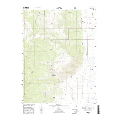
2017 Map of Wales
USGS Topo · Published 2017About this map
Wales sits at the eastern base of the San Pitch Mountains, where the rugged terrain of the Uinta National Forest meets the agricultural expanse of the Sanpete Valley. The town's grid is bounded by River Lane Rd and Resovoir Rd, with the Wales Cem located just south of the main settlement. This landscape is defined by the transition from high peaks like Big Mtn and Horse Mtn down to the drainage basin of the San Pitch River. Numerous deeply cut drainages, including Coal Canyon, Ax Handle Canyon, and Magistrate Canyon, segment the mountain front. To the west, the map tracks the boundary between Juab and Sanpete counties across high-elevation features such as Sage Flat and Jacks Hollow, illustrating the difficult geography that separates these two regions.
Find a feature on this map
31 named features on this map. Tap any name to fly to it.
Don’t see what you’re looking for? This feature index may not catch every label — zoom into the map to look around manually.
Map Details
Editions of this 2017 Wales Map
This is the sole edition of this map. No revisions or reprints were ever made.
Other maps of this area

1885 · Manti
USGS Topo · 1:250,000

1895 · Manti
USGS Topo · 1:250,000

1951 · Moroni
USGS Topo · 1:62,500

1951 · Nephi
USGS Topo · 1:62,500

1956 · Price
USGS Topo · 1:250,000

1960 · Price
USGS Topo · 1:250,000

1962 · Price
USGS Topo · 1:250,000

1965 · Chriss Canyon
USGS Topo · 1:24,000

1965 · Hells Kitchen Canyon SE
USGS Topo · 1:24,000

1965 · Manti
USGS Topo · 1:24,000