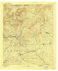
1892 Map of Walhalla
USGS Topo · Published 1943About this map
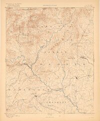
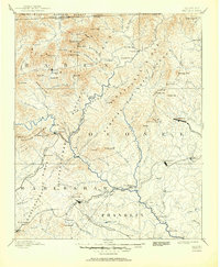
Walhalla and the mountain frontier of Oconee County anchor this late 19th-century study, where the Chattooga River defines the rugged border between Georgia and South Carolina. The landscape is a network of early transport routes, from the mountain gaps like Rabun Gap and Keener Gap to the numerous river crossings including Jenkins Ferry and Shelor Ferry. The map captures a critical era for the region's industry and connectivity, showing the Blue Ridge Railroad terminating near Walhalla while the Elberton Air Line Railroad and North Eastern Georgia Railroad push through the foothills toward Toccoa. Cultural landmarks like Oconee Station and Fort Madison reflect the area's transition from an outpost to a settled agricultural and rail-oriented economy. Notable natural features such as Estatoah Falls and the Tallulah Mountains illustrate the dramatic relief that shaped these early communities.
Find a feature on this map
120 named features on this map. Tap any name to fly to it.
Don’t see what you’re looking for? This feature index may not catch every label — zoom into the map to look around manually.
Map Details
Editions of this 1892 Walhalla Map
7 editions found
Other maps of this area

1886 · Dahlonega
USGS Topo · 1:125,000

1886 · Walhalla
USGS Topo · 1:125,000

1888 · Pickens
USGS Topo · 1:125,000

1891 · Cowee
USGS Topo · 1:125,000

1891 · Gainesville
USGS Topo · 1:125,000

1891 · Carnesville
USGS Topo · 1:125,000

1892 · Dahlonega
USGS Topo · 1:125,000

1892 · Walhalla
USGS Topo · 1:125,000

1893 · Elberton
USGS Topo · 1:125,000

1894 · Pickens
USGS Topo · 1:125,000