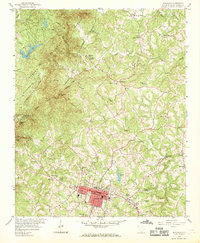
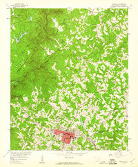
1959 Map of Walhalla
USGS Topo · Published 1969About this map
Walhalla serves as the focal point of this Oconee County survey, situated at the base of the Blue Ridge foothills where the Southern railroad terminates. The landscape is defined by the significant civil engineering efforts of the 19th century, most notably the Stumphouse Mtn Tunnel and associated segments like the Middle Tunnel and Saddle Tunnel. These unfinished railroad passages, alongside an extensive Old Railroad Grade, trace a failed attempt to connect the region to the Ohio Valley.
Find a feature on this map
48 named features on this map. Tap any name to fly to it.
Don’t see what you’re looking for? This feature index may not catch every label — zoom into the map to look around manually.
Map Details
Editions of this 1959 Walhalla Map
5 editions found
Other maps of this area

1886 · Walhalla
USGS Topo · 1:125,000

1888 · Pickens
USGS Topo · 1:125,000

1892 · Walhalla
USGS Topo · 1:125,000

1894 · Pickens
USGS Topo · 1:125,000

1896 · Walhalla
USGS Topo · 1:125,000

1954 · Greenville
USGS Topo · 1:250,000

1958 · Greenville
USGS Topo · 1:250,000

1958 · Seneca
USGS Topo · 1:24,000

1959 · Salem
USGS Topo · 1:24,000
1959 · Walhalla
USGS Topo · 1:24,000