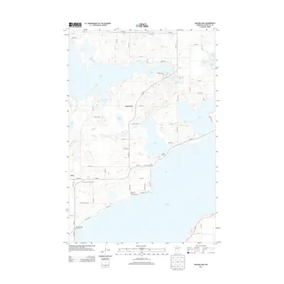
2013 Map of Walker Lake
USGS Topo · Published 2013About this map
Otter Tail Lake dominates the southern portion of this landscape, its expansive shoreline dotted with recreational sites like Red Lantern Resort and Campground and Tail Lake Campground. This area of central Minnesota is defined by a dense network of water bodies, including Walker Lake, Dead Lake, and the winding Dead River, which connect small settlements such as Amor and Basswood. The map provides significant genealogical value through its marking of local burial sites, such as the Zion Lutheran Church Cem and Oakwood Cem, alongside the Otter Tail County Sanitorium Cem. The landscape is a mix of lakefront activity and rural townships, exemplified by Camp Nidaros on the shores of Walker Lake and the numerous township roads that weave between smaller basins like Lake Alice and Indian Lake.
Find a feature on this map
56 named features on this map. Tap any name to fly to it.
Don’t see what you’re looking for? This feature index may not catch every label — zoom into the map to look around manually.
Map Details
Editions of this 2013 Walker Lake Map
This is the sole edition of this map. No revisions or reprints were ever made.
Other maps of this area

1912 · Vergas
USGS Topo · 1:62,500

1912 · Battle Lake
USGS Topo · 1:62,500

1914 · Battle Lake
USGS Topo · 1:62,500

1915 · Underwood
USGS Topo · 1:62,500

1915 · Perham
USGS Topo · 1:62,500

1915 · Vergas
USGS Topo · 1:62,500

1953 · Brainerd
USGS Topo · 1:250,000

1957 · Brainerd
USGS Topo · 1:250,000

1958 · Brainerd
USGS Topo · 1:250,000

1965 · Brainerd
USGS Topo · 1:250,000