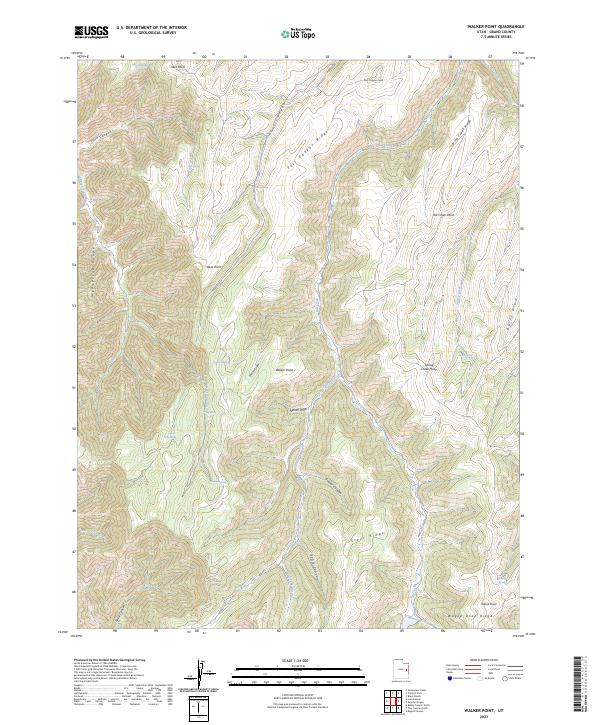
2023 Map of Walker Point
USGS Topo · Published 2023About this map
McPherson Range and the high plateaus of Grand County define this 2023 survey of eastern Utah's high desert. The landscape is characterized by a series of prominent finger ridges, most notably Post Canyon Ridge, Spring Creek Ridge, and Steer Ridge, which separate deeply incised drainage systems. These canyons, such as Beaver Canyon and Jennie Canyon, provide the primary relief in an otherwise upland environment centered on the geographic landmark of Walker Point.
Find a feature on this map
34 named features on this map. Tap any name to fly to it.
Don’t see what you’re looking for? This feature index may not catch every label — zoom into the map to look around manually.
Map Details
Editions of this 2023 Walker Point Map
This is the sole edition of this map. No revisions or reprints were ever made.
Other maps of this area

1885 · East Tavaputs
USGS Topo · 1:250,000

1956 · Grand Junction
USGS Topo · 1:250,000

1959 · Grand Junction
USGS Topo · 1:250,000

1960 · Grand Junction
USGS Topo · 1:250,000

1962 · Grand Junction
USGS Topo · 1:250,000

1963 · Tenmile Canyon
USGS Topo · 1:62,500

1963 · Moonwater Point
USGS Topo · 1:62,500
1963 · Floy Canyon
USGS Topo · 1:62,500

1963 · Sego Canyon
USGS Topo · 1:62,500

1964 · Grand Junction
USGS Topo · 1:250,000