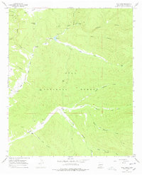
1967 Map of Wall Lake
USGS Topo · Published 1978About this map
Wall Lake and the confluence of its surrounding waterways serve as the focal point for this wilderness survey. Situated within the Gila National Forest, the landscape is defined by the complex drainage systems of Taylor Creek, Beaver Creek, and the East Fork of the Gila River. Ranching activity is evident along the riverbanks, where the DD Ranch and Steeple U Ranch are located.
Find a feature on this map
37 named features on this map. Tap any name to fly to it.
Don’t see what you’re looking for? This feature index may not catch every label — zoom into the map to look around manually.
Map Details
Editions of this 1967 Wall Lake Map
2 editions found
Other maps of this area

1911 · Alum Mountain
USGS Topo · 1:125,000

1913 · Alum Mountain
USGS Topo · 1:125,000

1949 · Lookout Mountain
USGS Topo · 1:62,500

1954 · Tularosa
USGS Topo · 1:250,000

1954 · Clifton
USGS Topo · 1:250,000

1957 · Clifton
USGS Topo · 1:250,000

1958 · Clifton
USGS Topo · 1:250,000

1958 · Tularosa
USGS Topo · 1:250,000

1962 · Clifton
USGS Topo · 1:250,000

1963 · Bonner Canyon
USGS Topo · 1:24,000