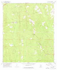
1960 Map of Wallace
USGS Topo · Published 1977About this map
The Louisville and Nashville railroad corridor anchors this 1960s study of rural Escambia County, passing directly through the small community of Wallace. The landscape is a network of creek drainages, including the Little Escambia Creek and Wild Fork Creek, where agricultural clearings meet thicket and timberland. Family names and community centers are preserved through landmarks like Hanberry Cem and Hanberry Ch, while the southern reaches of the map are defined by a strictly organized system of firebreaks, indicating managed forestry or fire control measures in the pine-heavy terrain.
Find a feature on this map
26 named features on this map. Tap any name to fly to it.
Don’t see what you’re looking for? This feature index may not catch every label — zoom into the map to look around manually.
Map Details
Editions of this 1960 Wallace Map
3 editions found
Other maps of this area

1953 · Andalusia
USGS Topo · 1:250,000

1957 · Andalusia
USGS Topo · 1:250,000

1959 · Brewton South
USGS Topo · 1:24,000

1960 · Brewton South
USGS Topo · 1:24,000

1960 · Pollard
USGS Topo · 1:24,000

1960 · Brewton North
USGS Topo · 1:24,000

1960 · Barnett Crossroads
USGS Topo · 1:24,000

1960 · Wallace
USGS Topo · 1:24,000
1960 · Flomaton
USGS Topo · 1:24,000

1971 · Range
USGS Topo · 1:24,000