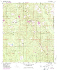
1960 Map of Wallace
USGS Topo · Published 1986About this map
Little Escambia Creek and its many tributaries, including Wild Fork Creek and Dean Creek, define the topography of this Escambia County landscape. The area is characterized by a network of timberlands and rural homesteads connected by a legacy of transport and faith. The Seaboard railroad corridor runs north-south through the center of the sheet, anchoring the settlement at Wallace. Local community life is centered around several country churches and family burial grounds, such as Hanberry Ch, Pleasant Hill Ch, and Hammac Cem.
Find a feature on this map
22 named features on this map. Tap any name to fly to it.
Don’t see what you’re looking for? This feature index may not catch every label — zoom into the map to look around manually.
Map Details
Editions of this 1960 Wallace Map
3 editions found
Other maps of this area

1953 · Andalusia
USGS Topo · 1:250,000

1957 · Andalusia
USGS Topo · 1:250,000

1959 · Brewton South
USGS Topo · 1:24,000

1960 · Brewton South
USGS Topo · 1:24,000

1960 · Pollard
USGS Topo · 1:24,000

1960 · Brewton North
USGS Topo · 1:24,000

1960 · Barnett Crossroads
USGS Topo · 1:24,000

1960 · Wallace
USGS Topo · 1:24,000
1960 · Flomaton
USGS Topo · 1:24,000

1971 · Range
USGS Topo · 1:24,000