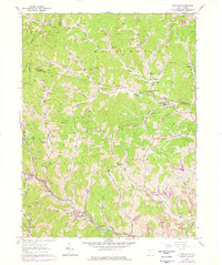
1960 Map of Wallace
USGS Topo · Published 1978About this map
Deep hollows and gas-producing ridges define this area of North-Central West Virginia, where the Baltimore and Ohio railroad corridor follows the winding banks of Little Tenmile Creek. This mid-century survey reveals a landscape heavily transitioned to energy production, dotted with dozens of gas wells and coal extraction sites like the Strip Mine and Tipple near Jimtown. Small rural communities such as Wallace, Brown, and Dola serve as local anchors, while numerous family-named burial grounds like Cunningham Cem and Scritchfield Cem are tucked into the steep topography of the Mannington and Eagle districts. The infrastructure of rural education and faith is still visible through landmarks like Duncan Sch and Eslar Chapel, marking the social centers for remote farmsteads and miners in the Harrison Co and Marion Co borderlands.
Find a feature on this map
73 named features on this map. Tap any name to fly to it.
Don’t see what you’re looking for? This feature index may not catch every label — zoom into the map to look around manually.
Map Details
Editions of this 1960 Wallace Map
2 editions found
Other maps of this area

1902 · Clarksburg
USGS Topo · 1:62,500

1903 · Littleton
USGS Topo · 1:62,500

1905 · Mannington
USGS Topo · 1:62,500

1905 · Centerpoint
USGS Topo · 1:62,500

1905 · Littleton
USGS Topo · 1:62,500

1910 · Clarksburg
USGS Topo · 1:62,500

1923 · Mannington
USGS Topo · 1:62,500

1923 · Clarksburg
USGS Topo · 1:62,500

1924 · Centerpoint
USGS Topo · 1:62,500

1924 · Littleton
USGS Topo · 1:62,500