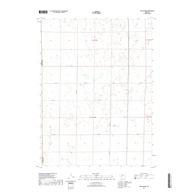
2017 Map of Wallace NW
USGS Topo · Published 2017About this map
Red Willow Cr meanders through the southwestern corner of this landscape in Lincoln and Perkins counties, providing a vital water source in an otherwise high-plains environment. The area is defined by a rigorous section-line grid, where roads like Line Rd W, 7 Mile Rd W, and Swanson Rd facilitate travel across the expansive agricultural allotments. These corridors, such as S Wallace Rd and S Parker Rd, illustrate the systematic organization of the Nebraska prairie during the early 21st century. The map highlights the boundary between Perkins and Lincoln counties, marked by Co Line Rd. This survey documents the persistent rural character of the region, where the naming of local routes like Lone Star Rd and W Corn Rd reflects the deep-rooted farming heritage and localized geography of the plains.
Find a feature on this map
17 named features on this map. Tap any name to fly to it.
Don’t see what you’re looking for? This feature index may not catch every label — zoom into the map to look around manually.
Map Details
Editions of this 2017 Wallace NW Map
This is the sole edition of this map. No revisions or reprints were ever made.
Other maps of this area

1898 · Paxton
USGS Topo · 1:125,000

1901 · Paxton
USGS Topo · 1:125,000

1954 · McCook
USGS Topo · 1:250,000

1954 · North Platte
USGS Topo · 1:250,000

1956 · North Platte
USGS Topo · 1:250,000

1957 · North Platte
USGS Topo · 1:250,000

1957 · McCook
USGS Topo · 1:250,000

1958 · McCook
USGS Topo · 1:250,000

1967 · North Platte
USGS Topo · 1:250,000

1971 · Sutherland Reservoir West
USGS Topo · 1:24,000