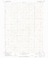
1973 Map of Wallace NW
USGS Topo · Published 1977About this map
Red Willow Creek meanders through the southwestern corner of this Nebraska landscape, defining a terrain shaped by the rolling sand hills typical of the High Plains. Surveyed in 1973, the map illustrates a sparsely populated agricultural region where the boundary between Perkins Co and Lincoln Co runs north-south through the western sections. The rural infrastructure of the early 1970s is characterized by a prominent east-west Pipeline and a geometric network of section-line roads and field boundaries. This topographic study captures a specific moment in Great Plains land management, highlighting the intersection of natural drainage systems and modern industrial utility corridors in a landscape dedicated primarily to ranching and dryland farming.
Find a feature on this map
3 named features on this map. Tap any name to fly to it.
Don’t see what you’re looking for? This feature index may not catch every label — zoom into the map to look around manually.
Map Details
Editions of this 1973 Wallace NW Map
This is the sole edition of this map. No revisions or reprints were ever made.
Other maps of this area

1898 · Paxton
USGS Topo · 1:125,000

1901 · Paxton
USGS Topo · 1:125,000

1954 · McCook
USGS Topo · 1:250,000

1954 · North Platte
USGS Topo · 1:250,000

1956 · North Platte
USGS Topo · 1:250,000

1957 · North Platte
USGS Topo · 1:250,000

1957 · McCook
USGS Topo · 1:250,000

1958 · McCook
USGS Topo · 1:250,000

1967 · North Platte
USGS Topo · 1:250,000

1971 · Sutherland Reservoir West
USGS Topo · 1:24,000