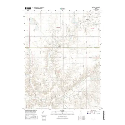
2016 Map of Wallace
USGS Topo · Published 2016About this map
Wallace and Grange Corner anchor this landscape along the border of Fountain and Parke Counties, where deep creek valleys carve through the central Indiana plains. The winding course of Sugar Creek dominates the southern half of the map, notable for its concentration of structural history including the Wilkins Mill Covered Bridge, Cox Ford Covered Bridge, and the Narrows Bridge near Rocky Hollow. These crossings suggest a long-standing reliance on the river corridor for local transport and commerce. Away from the water, the survey reveals a network of rural life marked by small family and community burial grounds such as Cashatt Cem, Zackmire Cem, and Nolen Cem. The presence of Wilson Airport and numerous named tributaries like Sugar Mill Creek and Stillwater Cr further define a region where agricultural land use is tightly integrated with the natural drainage patterns of the Wabash River watershed.
Find a feature on this map
84 named features on this map. Tap any name to fly to it.
Don’t see what you’re looking for? This feature index may not catch every label — zoom into the map to look around manually.
Map Details
Editions of this 2016 Wallace Map
This is the sole edition of this map. No revisions or reprints were ever made.
Other maps of this area

1948 · Wallace
USGS Topo · 1:24,000

1949 · Alamo
USGS Topo · 1:24,000

1953 · Danville
USGS Topo · 1:250,000

1953 · Indianapolis
USGS Topo · 1:250,000

1955 · Danville
USGS Topo · 1:250,000

1955 · Rockville
USGS Topo · 1:24,000

1955 · Kingman
USGS Topo · 1:24,000

1955 · Montezuma
USGS Topo · 1:24,000

1956 · Danville
USGS Topo · 1:250,000

1956 · Indianapolis
USGS Topo · 1:250,000