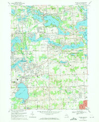
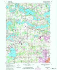
1969 Map of Walled Lake
USGS Topo · Published 1971About this map
Glacial lakes dominate this portion of Oakland County, reflecting a landscape shaped by water and mid-century suburban expansion. The sprawling Walled Lake and Wolverine Lake serve as anchors for the communities of Commerce and Novi, where a network of schools such as Walled Lake High Sch and Smart Jr High Sch indicates a period of rapid residential growth. The Grand Trunk Western railroad cuts across the terrain, passing through the heart of the settlement at Walled Lake and connecting the area to broader Michigan markets.
Find a feature on this map
112 named features on this map. Tap any name to fly to it.
Don’t see what you’re looking for? This feature index may not catch every label — zoom into the map to look around manually.
Map Details
Editions of this 1969 Walled Lake Map
5 editions found
Other maps of this area

1902 · South Lyon
USGS Topo · 1:62,500

1904 · Ann Arbor
USGS Topo · 1:125,000

1905 · Wayne
USGS Topo · 1:62,500

1906 · South Lyon
USGS Topo · 1:62,500

1907 · Pontiac
USGS Topo · 1:62,500

1908 · Ann Arbor
USGS Topo · 1:125,000

1909 · Milford
USGS Topo · 1:62,500

1912 · Wayne
USGS Topo · 1:62,500

1936 · Wixom
USGS Topo · 1:31,680

1936 · Highland
USGS Topo · 1:31,680
Featured Places
- Farmington Hills, MI
- Waterford Township, MI
- Novi, MI
- West Bloomfield Township, MI
- Commerce Charter Township, MI