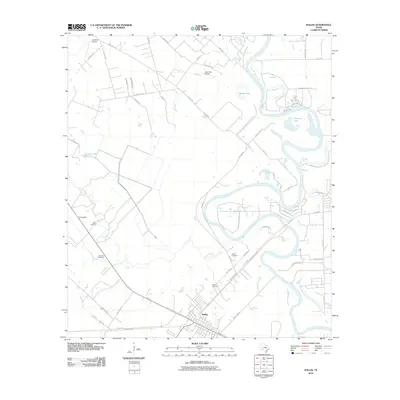
2010 Map of Wallis
USGS Topo · Published 2010About this map
The Brazos River meanders sharply through this Austin County landscape, defining the local geography alongside Allens Creek. The settlement of Wallis serves as the primary hub, showing a structured grid of streets intersected by several regional routes. This 2010 survey highlights a rural economy transitioning into more modern land uses, evidenced by the presence of the Longbird Airport and Clark Sky Ranch alongside traditional agricultural holdings like Riverbend Ranch. For family historians, the map is particularly valuable for its precise location of burial grounds, including Allens Cemetery, Hartville Cemetery, and two distinct sites labeled as Wallis Cemetery. Small oxbow water bodies such as Wards Lake and Cannons Lake remain as visible markers of the river's historical shifts over time.
Find a feature on this map
56 named features on this map. Tap any name to fly to it.
Don’t see what you’re looking for? This feature index may not catch every label — zoom into the map to look around manually.
Map Details
Editions of this 2010 Wallis Map
This is the sole edition of this map. No revisions or reprints were ever made.
Other maps of this area

1950 · Houston
USGS Topo · 1:250,000

1953 · Seguin
USGS Topo · 1:250,000

1955 · Brookshire
USGS Topo · 1:62,500

1955 · Richmond
USGS Topo · 1:62,500

1956 · Sealy
USGS Topo · 1:62,500

1956 · Wallis
USGS Topo · 1:62,500

1956 · Houston
USGS Topo · 1:250,000

1958 · Seguin
USGS Topo · 1:250,000

1960 · Lissie
USGS Topo · 1:24,000

1960 · Wallis
USGS Topo · 1:24,000