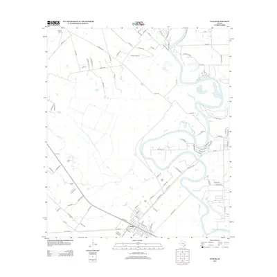
2013 Map of Wallis
USGS Topo · Published 2013About this map
The Brazos River meanders through this Austin County landscape, creating a series of dramatic oxbows and cut-offs like Cannons Lake and Wards Lake. At the southern edge of the survey, the town of Wallis serves as a local hub where residential streets intersect with the Railroad St corridor. The area’s aviation presence is notable, with both the Gloster Aerodrome and Longbird Airport positioned north of the primary settlement.
Find a feature on this map
100 named features on this map. Tap any name to fly to it.
Don’t see what you’re looking for? This feature index may not catch every label — zoom into the map to look around manually.
Map Details
Editions of this 2013 Wallis Map
This is the sole edition of this map. No revisions or reprints were ever made.
Other maps of this area

1950 · Houston
USGS Topo · 1:250,000

1953 · Seguin
USGS Topo · 1:250,000

1955 · Brookshire
USGS Topo · 1:62,500

1955 · Richmond
USGS Topo · 1:62,500

1956 · Sealy
USGS Topo · 1:62,500

1956 · Wallis
USGS Topo · 1:62,500

1956 · Houston
USGS Topo · 1:250,000

1958 · Seguin
USGS Topo · 1:250,000

1960 · Lissie
USGS Topo · 1:24,000

1960 · Wallis
USGS Topo · 1:24,000