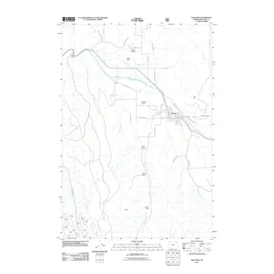
2011 Map of Wallowa
USGS Topo · Published 2011About this map
The Wallowa River flows through a landscape defined by ranching and water management in this 2011 survey of the valley. The town of Wallowa serves as the central hub, supported by the Wallowa Post Office and connected by a network of historic roads like Troy Rd and Riverside Ave. Local genealogy is well-represented by the Bramlet Memorial Cemetery in the north and the Wallowa Cemetery to the east, marking the resting places of the area's early families.
Find a feature on this map
45 named features on this map. Tap any name to fly to it.
Don’t see what you’re looking for? This feature index may not catch every label — zoom into the map to look around manually.
Map Details
Editions of this 2011 Wallowa Map
This is the sole edition of this map. No revisions or reprints were ever made.
Other maps of this area
1906 · Telocaset
USGS Topo · 1:125,000
1955 · Grangeville
USGS Topo · 1:250,000
1957 · Enterprise
USGS Topo · 1:62,500
1957 · Sled Springs
USGS Topo · 1:62,500
1959 · Grangeville
USGS Topo · 1:250,000
1964 · Howard Butte
USGS Topo · 1:24,000
1964 · Akers Butte
USGS Topo · 1:24,000
1964 · Wallowa
USGS Topo · 1:24,000
1964 · Minam
USGS Topo · 1:24,000
1965 · Fox Point
USGS Topo · 1:24,000