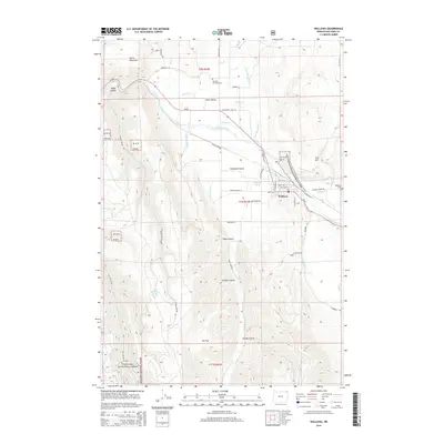
2014 Map of Wallowa
USGS Topo · Published 2014About this map
Wallowa stands at the confluence of several vital watercourses and transport routes in northeastern Oregon. The Wallowa River and its intricate system of irrigation, including the Lower Valley Ditch and Chamberlin Ditch, support the agricultural operations across Lower Valley and Diamond Prairie. The map highlights the intersection of public lands and local history, where the Wallowa National Forest meets the protected sites of the Nez Perce National Historical Park. Evidence of early settlement is found at the Bramlet Memorial Cem and Wallowa Cem, while the landscape shifts from the low-lying Elk Flat to the prominent peak of Smith Mountain. The layout of the town and surrounding canyons like Goebel Canyon reflects a community deeply integrated with the surrounding forest and ranching terrain.
Find a feature on this map
57 named features on this map. Tap any name to fly to it.
Don’t see what you’re looking for? This feature index may not catch every label — zoom into the map to look around manually.
Map Details
Editions of this 2014 Wallowa Map
This is the sole edition of this map. No revisions or reprints were ever made.
Other maps of this area

1906 · Telocaset
USGS Topo · 1:125,000

1955 · Grangeville
USGS Topo · 1:250,000

1957 · Enterprise
USGS Topo · 1:62,500

1957 · Sled Springs
USGS Topo · 1:62,500

1959 · Grangeville
USGS Topo · 1:250,000

1964 · Howard Butte
USGS Topo · 1:24,000

1964 · Akers Butte
USGS Topo · 1:24,000

1964 · Wallowa
USGS Topo · 1:24,000

1964 · Minam
USGS Topo · 1:24,000

1965 · Fox Point
USGS Topo · 1:24,000