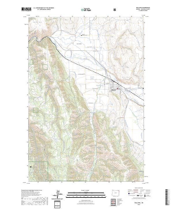
2023 Map of Wallowa
USGS Topo · Published 2023About this map
Wallowa serves as the primary hub in this corner of Northeast Oregon, where the Wallowa River flows through a broad valley floor before the landscape rises sharply into the Wallowa National Forest. The map documents a structured agricultural and ranching landscape, defined by an intricate network of irrigation features such as the Lower Valley Ditch, Chamberlin Ditch, and Clear Water Ditch. These waterways support the outlying settlements of Lower Valley and Diamond Prairie, illustrating the area's long-standing reliance on managed water systems. The topography is marked by significant elevations like Smith Mtn and Tick Hill, with deep incisions from Big Canyon and Goebel Canyon carving into the southern high ground. Family and local history are anchored by sites such as Bramlet Memorial Cem and Wallowa Cem, while the presence of the Post Office and Sasser Airstrip Rd highlights the community's infrastructure.
Find a feature on this map
62 named features on this map. Tap any name to fly to it.
Don’t see what you’re looking for? This feature index may not catch every label — zoom into the map to look around manually.
Map Details
Editions of this 2023 Wallowa Map
This is the sole edition of this map. No revisions or reprints were ever made.
Other maps of this area

1906 · Telocaset
USGS Topo · 1:125,000

1955 · Grangeville
USGS Topo · 1:250,000

1957 · Enterprise
USGS Topo · 1:62,500

1957 · Sled Springs
USGS Topo · 1:62,500

1959 · Grangeville
USGS Topo · 1:250,000

1964 · Howard Butte
USGS Topo · 1:24,000

1964 · Akers Butte
USGS Topo · 1:24,000

1964 · Wallowa
USGS Topo · 1:24,000

1964 · Minam
USGS Topo · 1:24,000

1965 · Fox Point
USGS Topo · 1:24,000