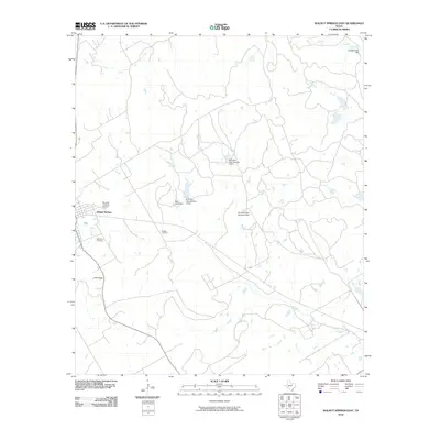
2010 Map of Walnut Springs East
USGS Topo · Published 2010About this map
Walnut Springs serves as the primary hub for this portion of Bosque County, situated at the edge of a landscape defined by seasonal watercourses and local water management systems. The town is flanked by key community markers including Oak Grove Cemetery to the south and Bryants Landing Airport just to the east. The surrounding countryside reveals a complex network of small dams and artificial reservoirs, such as El Colina Lake Number 2 Dam, El Colina Lake Number 3 Dam, and El Colina Lake Number 4 Dam, which suggest the importance of local water conservation in this central Texas environment.
Find a feature on this map
16 named features on this map. Tap any name to fly to it.
Don’t see what you’re looking for? This feature index may not catch every label — zoom into the map to look around manually.
Map Details
Editions of this 2010 Walnut Springs East Map
This is the sole edition of this map. No revisions or reprints were ever made.
Other maps of this area

1888 · Meridian
USGS Topo · 1:125,000

1889 · Granbury
USGS Topo · 1:125,000

1894 · Meridian
USGS Topo · 1:125,000

1924 · Granbury 4-a
USGS Topo · 1:48,000

1931 · Morgan
USGS Topo · 1:62,500

1954 · Dallas
USGS Topo · 1:250,000

1954 · Waco
USGS Topo · 1:250,000

1955 · Waco
USGS Topo · 1:250,000

1955 · Meridian
USGS Topo · 1:24,000
1955 · Pilot Knob
USGS Topo · 1:24,000