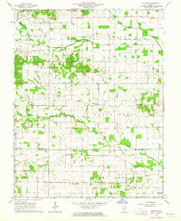
1963 Map of Walpole
USGS Topo · Published 1964About this map
Oil fields and scattered oil wells define the industrial footprint of this Hamilton and Saline County borderland during the early 1960s. The landscape is a network of small, rural crossroads communities such as Walpole, Rector, and Unity, many of which grew around early post offices and schools. This period shows the transition from traditional agriculture to a hybrid economy of farming and petroleum extraction, with numerous family-named landmarks and rural institutions remaining as focal points.
Find a feature on this map
42 named features on this map. Tap any name to fly to it.
Don’t see what you’re looking for? This feature index may not catch every label — zoom into the map to look around manually.
Map Details
Editions of this 1963 Walpole Map
2 editions found
Other maps of this area

1905 · Eldorado
USGS Topo · 1:62,500

1906 · Eldorado
USGS Topo · 1:62,500

1908 · Galatia
USGS Topo · 1:62,500

1938 · Galatia
USGS Topo · 1:62,500

1941 · Enfield
USGS Topo · 1:62,500

1942 · McLeansboro
USGS Topo · 1:62,500

1944 · Enfield
USGS Topo · 1:62,500

1945 · McLeansboro
USGS Topo · 1:62,500

1949 · Paducah
USGS Topo · 1:250,000

1950 · Paducah
USGS Topo · 1:250,000