
1918 Map of Walterboro
USGS Topo · Published 1918About this map
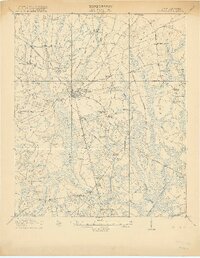
Walterboro serves as the hub of this 1918 survey, where the Atlantic Coast Line railroad and numerous local roads converge amidst the low-lying terrain of Colleton County. The landscape is defined by the expansive Great Swamp and the winding course of the Ashepoo River, which dictated early settlement patterns and transport routes. Numerous small communities and rural intersections such as Rhodes Crossroads, Smokes Corners, and Bluehouse Corners reflect a dispersed agricultural society dependent on local landmarks.
Find a feature on this map
70 named features on this map. Tap any name to fly to it.
Don’t see what you’re looking for? This feature index may not catch every label — zoom into the map to look around manually.
Map Details
Editions of this 1918 Walterboro Map
4 editions found
Other maps of this area

1918 · Green Pond
USGS Topo · 1:62,500

1918 · Yemassee
USGS Topo · 1:62,500

1918 · Cottageville
USGS Topo · 1:62,500

1919 · Edisto Island
USGS Topo · 1:62,500

1919 · Ridgeville
USGS Topo · 1:48,000

1919 · Cummings
USGS Topo · 1:62,500

1919 · Lodge
USGS Topo · 1:62,500

1920 · Lodge
USGS Topo · 1:48,000

1920 · Ridgeville
USGS Topo · 1:62,500

1920 · St. George
USGS Topo · 1:48,000