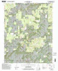
1996 Map of Waltersburg
USGS Topo · Published 1998About this map
The Shawnee National Forest dominates this section of Pope County, where the dense woodlands of the Lusk Creek Wilderness provide a backdrop for scattered rural settlements. Small communities like Eddyville, Raum, and Rising Sun serve as anchors for the surrounding landscape, which is defined by a complex network of narrow hollows and creeks. The topographic detail highlights the region's historical social fabric through its numerous country churches and family burial grounds, including the New Liberty Ch, Palestine Ch, and the isolated Barger Cem.
Find a feature on this map
34 named features on this map. Tap any name to fly to it.
Don’t see what you’re looking for? This feature index may not catch every label — zoom into the map to look around manually.
Map Details
Editions of this 1996 Waltersburg Map
2 editions found
Other maps of this area

1916 · Golconda
USGS Topo · 1:62,500

1916 · Equality
USGS Topo · 1:62,500

1917 · Brownfield
USGS Topo · 1:62,500

1920 · Goloonda
USGS Topo · 1:48,000

1921 · Golconda
USGS Topo · 1:62,500

1925 · Harrisburg
USGS Topo · 1:62,500

1939 · Harrisburg
USGS Topo · 1:62,500

1949 · Paducah
USGS Topo · 1:250,000

1950 · Paducah
USGS Topo · 1:250,000

1954 · Paducah
USGS Topo · 1:250,000