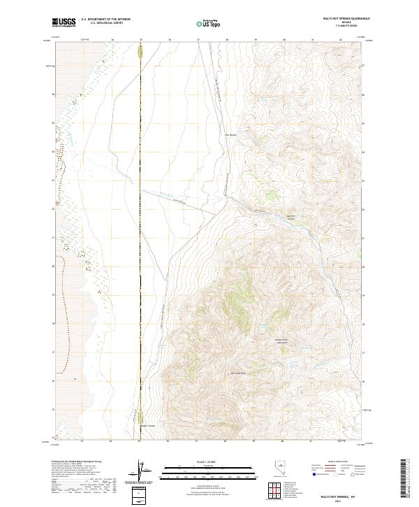
2021 Map of Walti Hot Springs
USGS Topo · Published 2021About this map
Walti Hot Springs serves as a central landmark in this high-desert landscape, situated along the border of Lander and Eureka counties. The topography is dominated by the northern reaches of the Simpson Park Mountains, where McClusky Peak rises above several named drainages and canyons. The distribution of water sources is critical in this arid environment, marked by numerous isolated springs including Potato Spring, Sage Hen Spring, and Rye Patch Spring.
Find a feature on this map
24 named features on this map. Tap any name to fly to it.
Don’t see what you’re looking for? This feature index may not catch every label — zoom into the map to look around manually.
Map Details
Editions of this 2021 Walti Hot Springs Map
This is the sole edition of this map. No revisions or reprints were ever made.
Other maps of this area

1926 · Roberts Mountains
USGS Topo · 1:250,000

1929 · Roberts Mountains
USGS Topo · 1:250,000

1938 · Cortez
USGS Topo · 1:48,000

1944 · Cortez
USGS Topo · 1:62,500

1949 · Roberts Creek Mtn
USGS Topo · 1:62,500

1951 · Roberts Creek Mtn
USGS Topo · 1:62,500

1955 · Millett
USGS Topo · 1:250,000

1955 · Winnemucca
USGS Topo · 1:250,000

1956 · Walti Hot Springs
USGS Topo · 1:62,500

1957 · Horse Creek Valley
USGS Topo · 1:62,500