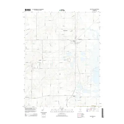
2015 Map of Waltonville
USGS Topo · Published 2015About this map
Waltonville serves as the central hub of this Jefferson County landscape, where the local road network converges near Waltonville Lake. To the west, the settlement of Scheller is home to Saint Barbara Cem, while the northern reaches include the community of Williamsburg and the drainage of Knob Prairie Cr. The terrain is defined by a dense distribution of family and community burial grounds, such as Gilbert Cem, Stephens Cem, and Clampet Cem, which provide significant points of interest for genealogical research. Water management is a visible priority across the quadrangle, evidenced by the East Lake Impoundment, an Auxiliary Reservoir, and the Raw Water Reservoir near Emerson City. The eastern border follows the winding course of the Big Muddy River, while Bald Hill stands as a prominent elevation point near the western margin.
Find a feature on this map
61 named features on this map. Tap any name to fly to it.
Don’t see what you’re looking for? This feature index may not catch every label — zoom into the map to look around manually.
Map Details
Editions of this 2015 Waltonville Map
This is the sole edition of this map. No revisions or reprints were ever made.
Other maps of this area

1926 · Duquoin
USGS Topo · 1:62,500

1933 · Mount Vernon
USGS Topo · 1:48,000

1939 · Ina
USGS Topo · 1:62,500

1940 · Mount Vernon
USGS Topo · 1:62,500

1943 · Ina
USGS Topo · 1:62,500

1943 · Ashley
USGS Topo · 1:62,500

1946 · Ashley
USGS Topo · 1:62,500

1958 · Belleville
USGS Topo · 1:250,000

1962 · Belleville
USGS Topo · 1:250,000
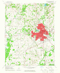
1965 · Mount Vernon
USGS Topo · 1:24,000