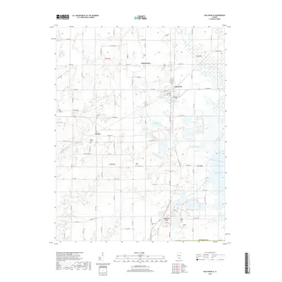
2018 Map of Waltonville
USGS Topo · Published 2018About this map
Waltonville sits at the center of this 2018 survey, serving as a focal point for a landscape defined by small-town settlements and a high density of ancestral burial grounds. The geography is structured by the Big Muddy River in the east and a network of creeks including Knob Prairie Cr and Rayse Creek. This map reveals the heavy management of local water resources for community and industrial use, evidenced by the Waltonville Lake, the E Lake Impoundment, and the Mine Number 21 Reservoir. Genealogists will find a wealth of specific landmarks, from the Saint Barbara Cem near Scheller to the isolated Old Baptist Cem and Clampet Cem in the south. The terrain is largely level, though the rise of Bald Hill provides a distinct change in elevation above Bald Hill Cr in the western portion of the quadrangle.
Find a feature on this map
65 named features on this map. Tap any name to fly to it.
Don’t see what you’re looking for? This feature index may not catch every label — zoom into the map to look around manually.
Map Details
Editions of this 2018 Waltonville Map
This is the sole edition of this map. No revisions or reprints were ever made.
Other maps of this area

1926 · Duquoin
USGS Topo · 1:62,500

1933 · Mount Vernon
USGS Topo · 1:48,000

1939 · Ina
USGS Topo · 1:62,500

1940 · Mount Vernon
USGS Topo · 1:62,500

1943 · Ina
USGS Topo · 1:62,500

1943 · Ashley
USGS Topo · 1:62,500

1946 · Ashley
USGS Topo · 1:62,500

1958 · Belleville
USGS Topo · 1:250,000

1962 · Belleville
USGS Topo · 1:250,000
1965 · Mount Vernon
USGS Topo · 1:24,000