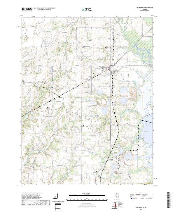
2024 Map of Waltonville
USGS Topo · Published 2024About this map
Waltonville and its surrounding rural hamlets anchor this Jefferson County landscape, defined by a complex network of creeks and drainage basins. The village sits just north of Waltonville Lake, while smaller settlements like Scheller, Williamsburg, and Emerson City are connected by a grid of county roads such as Co Rd 700 N and Co Hwy 26. This modern survey reveals a highly managed hydrological environment, featuring the Auxiliary Reservoir and Mine Number 21 Reservoir alongside natural watercourses like Knob Prairie Creek and Buck Creek. Genealogists will find a wealth of burial sites scattered across the township, from the centrally located Saint Barbara Cem near Scheller to the Horse Prairie Cem in the southeast. The terrain transitions toward the Big Muddy River on the eastern edge, showing the modern intersection of agriculture and industrial water management.
Find a feature on this map
55 named features on this map. Tap any name to fly to it.
Don’t see what you’re looking for? This feature index may not catch every label — zoom into the map to look around manually.
Map Details
Editions of this 2024 Waltonville Map
This is the sole edition of this map. No revisions or reprints were ever made.
Other maps of this area

1926 · Duquoin
USGS Topo · 1:62,500

1933 · Mount Vernon
USGS Topo · 1:48,000

1939 · Ina
USGS Topo · 1:62,500

1940 · Mount Vernon
USGS Topo · 1:62,500

1943 · Ina
USGS Topo · 1:62,500

1943 · Ashley
USGS Topo · 1:62,500

1946 · Ashley
USGS Topo · 1:62,500

1958 · Belleville
USGS Topo · 1:250,000

1962 · Belleville
USGS Topo · 1:250,000
1965 · Mount Vernon
USGS Topo · 1:24,000