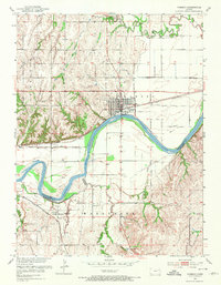
1953 Map of Wamego
USGS Topo · Published 1973About this map
The Kansas River carves a significant path through this 1950s landscape, serving as the dividing line between Pottawatomie and Wabaunsee counties. The settlement of Wamego stands as the primary hub, situated where the Union Pacific railroad parallels the river. A short distance south across the water, the smaller village of Wabaunsee is reached by roads winding through the river bottomlands.
Find a feature on this map
22 named features on this map. Tap any name to fly to it.
Don’t see what you’re looking for? This feature index may not catch every label — zoom into the map to look around manually.
Map Details
Editions of this 1953 Wamego Map
3 editions found
Other maps of this area

1889 · Wamego
USGS Topo · 1:125,000

1894 · Wamego
USGS Topo · 1:125,000

1953 · Wamego
USGS Topo · 1:24,000

1953 · St George
USGS Topo · 1:24,000

1953 · Belvue
USGS Topo · 1:24,000
1953 · Wamego SW
USGS Topo · 1:24,000

1954 · Alma
USGS Topo · 1:24,000

1954 · Mc Farland
USGS Topo · 1:24,000

1955 · Manhattan
USGS Topo · 1:250,000

1956 · Manhattan
USGS Topo · 1:250,000