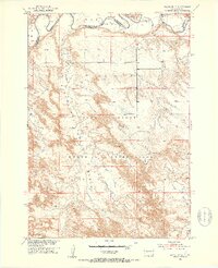
1951 Map of Wanblee NE
USGS Topo · Published 1953About this map
The winding White River defines the northern boundary of this 1951 survey, where the rugged terrain of the Pine Ridge Indian Reservation meets the river valley. This landscape is marked by deep drainage systems and high vantage points like Kodak Point, illustrating the complex topography of the Basin region. The mapping reflects a sparsely populated area during the early postwar period, as part of the Missouri River Basin development program.
Find a feature on this map
13 named features on this map. Tap any name to fly to it.
Don’t see what you’re looking for? This feature index may not catch every label — zoom into the map to look around manually.
Map Details
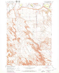
Editions of this 1951 Wanblee NE Map
3 editions found
Other maps of this area

1950 · Wanblee
USGS Topo · 1:24,000

1950 · Weta
USGS Topo · 1:24,000

1951 · Wanblee NW
USGS Topo · 1:24,000

1951 · Pass Creek NW
USGS Topo · 1:24,000

1951 · Kadoka
USGS Topo · 1:24,000

1951 · Belvidere SW
USGS Topo · 1:24,000

1951 · Wanblee NE
USGS Topo · 1:24,000

1955 · Martin
USGS Topo · 1:250,000

1958 · Martin
USGS Topo · 1:250,000

1980 · Kadoka
USGS Topo · 1:100,000