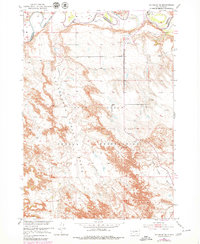
1951 Map of Wanblee NE
USGS Topo · Published 1979About this map
The White River carves a sharp, winding course across the northern reaches of this landscape, forming a natural boundary near the transition between Jackson and Washabaugh Counties. Much of the territory falls within the Pine Ridge Indian Reservation, where the topography rises from the river lowlands into the prominent heights of Pine Ridge. This escarpment dominates the central portion of the sheet, creating a dramatic divide between the river valley and the broken drainages to the south.
Find a feature on this map
21 named features on this map. Tap any name to fly to it.
Don’t see what you’re looking for? This feature index may not catch every label — zoom into the map to look around manually.
Map Details
Editions of this 1951 Wanblee NE Map
3 editions found
Other maps of this area

1950 · Wanblee
USGS Topo · 1:24,000

1950 · Weta
USGS Topo · 1:24,000

1951 · Wanblee NW
USGS Topo · 1:24,000

1951 · Pass Creek NW
USGS Topo · 1:24,000

1951 · Kadoka
USGS Topo · 1:24,000

1951 · Belvidere SW
USGS Topo · 1:24,000

1951 · Wanblee NE
USGS Topo · 1:24,000

1955 · Martin
USGS Topo · 1:250,000

1958 · Martin
USGS Topo · 1:250,000

1980 · Kadoka
USGS Topo · 1:100,000