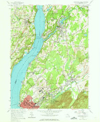
1956 Map of Wappingers Falls
USGS Topo · Published 1965About this map
The Hudson River serves as the central artery for this mid-century portrait of Dutchess, Orange, and Ulster Counties, where the water-level tracks of the New York Central railroad skirt the eastern bank. The industrial and institutional character of the era is evident in the presence of the sprawling Matteawan State Hospital and the U S Veterans Hospital near Castle Point. Along the river's edge, heavy industry is represented by the Quarry and Clay Pit operations near Roseton, while the northern reach shows the Childrens Aid Society Camps near New Hamburg.
Find a feature on this map
79 named features on this map. Tap any name to fly to it.
Don’t see what you’re looking for? This feature index may not catch every label — zoom into the map to look around manually.
Map Details
Editions of this 1956 Wappingers Falls Map
3 editions found
Other maps of this area

1892 · West Point
USGS Topo · 1:62,500

1893 · Poughkeepsie
USGS Topo · 1:62,500

1894 · West Point
USGS Topo · 1:62,500

1894 · Poughkeepsie
USGS Topo · 1:62,500

1899 · West Point
USGS Topo · 1:62,500

1901 · West Point
USGS Topo · 1:62,500

1902 · Schunemunk
USGS Topo · 1:62,500

1903 · Poughkeepsie
USGS Topo · 1:62,500

1903 · Newburg
USGS Topo · 1:62,500

1930 · Schunemunk
USGS Topo · 1:48,000