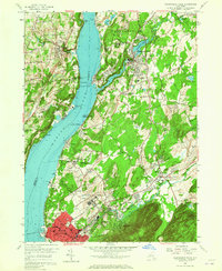
1956 Map of Wappingers Falls
USGS Topo · Published 1973About this map
The Hudson River corridor serves as the primary artery for industry and institutional development in this mid-1950s survey of Dutchess and Orange counties. Significant healthcare and religious facilities dominate the landscape east of the river, notably the expansive grounds of Matteawan State Hospital and the U S Veterans Hospital at Castle Point. On the western shore, the settlements of Marlboro and Roseton are defined by the New York Central rail line and a series of riverfront industrial sites, including a Quarry and a Clay Pit. Infrastructure for the City of New York Delaware Water Supply is marked near Chelsea, highlighting the region's role in supporting urban utility networks. Smaller villages like Wappingers Falls and Glenham maintain their historic character along the banks of Wappinger Creek and Fishkill Creek, where several local schools and churches serve the growing population centers.
Find a feature on this map
70 named features on this map. Tap any name to fly to it.
Don’t see what you’re looking for? This feature index may not catch every label — zoom into the map to look around manually.
Map Details
Editions of this 1956 Wappingers Falls Map
3 editions found
Other maps of this area

1892 · West Point
USGS Topo · 1:62,500

1893 · Poughkeepsie
USGS Topo · 1:62,500

1894 · West Point
USGS Topo · 1:62,500

1894 · Poughkeepsie
USGS Topo · 1:62,500

1899 · West Point
USGS Topo · 1:62,500

1901 · West Point
USGS Topo · 1:62,500

1902 · Schunemunk
USGS Topo · 1:62,500

1903 · Poughkeepsie
USGS Topo · 1:62,500

1903 · Newburg
USGS Topo · 1:62,500

1930 · Schunemunk
USGS Topo · 1:48,000