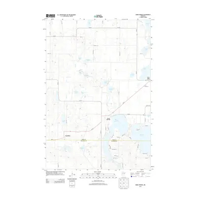
2013 Map of Ward Springs
USGS Topo · Published 2013About this map
Ward Springs and the village of Grey Eagle anchor this central Minnesota landscape, where the boundary between Todd Co and Stearns Co bisects a region defined by its glacial lakes. The settlement of Spaulding sits along a quiet stretch of road west of the major water bodies, while the eastern portion is dominated by the sprawling reaches of Big Birch Lake and Little Birch Lake. The terrain is characterized by numerous small basins and ponds, including Feucht Lake, Pauley Lake, and the uniquely named D Peschel Pond, reflecting the complex hydrology of the area.
Find a feature on this map
49 named features on this map. Tap any name to fly to it.
Don’t see what you’re looking for? This feature index may not catch every label — zoom into the map to look around manually.
Map Details
Editions of this 2013 Ward Springs Map
This is the sole edition of this map. No revisions or reprints were ever made.
Other maps of this area

1950 · Swanville
USGS Topo · 1:62,500

1953 · Saint Cloud
USGS Topo · 1:250,000

1957 · Saint Cloud
USGS Topo · 1:250,000

1958 · Saint Cloud
USGS Topo · 1:250,000

1965 · Sauk Centre
USGS Topo · 1:24,000

1965 · Melrose
USGS Topo · 1:24,000

1965 · Freeport
USGS Topo · 1:24,000
1966 · Sauk Lake
USGS Topo · 1:24,000
1966 · Long Prairie
USGS Topo · 1:24,000
1966 · Round Prairie
USGS Topo · 1:24,000