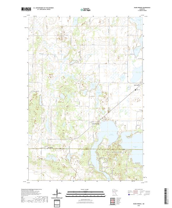
2022 Map of Ward Springs
USGS Topo · Published 2022About this map
Ward Springs and the surrounding central Minnesota lakelands are captured in this modern topographic survey, detailing a landscape defined by glacial activity and rural settlement. The map highlights the transition between Todd and Stearns Counties, featuring the clustered waters of Big Birch Lake and Little Birch Lake in the south and Big Swan Lake to the northeast. These water bodies, along with smaller features like Bunker Lake and Zager Lake, shaped the early development of communities such as Grey Eagle and the settlement at Spaulding.
Find a feature on this map
86 named features on this map. Tap any name to fly to it.
Don’t see what you’re looking for? This feature index may not catch every label — zoom into the map to look around manually.
Map Details
Editions of this 2022 Ward Springs Map
This is the sole edition of this map. No revisions or reprints were ever made.
Other maps of this area

1950 · Swanville
USGS Topo · 1:62,500

1953 · Saint Cloud
USGS Topo · 1:250,000

1957 · Saint Cloud
USGS Topo · 1:250,000

1958 · Saint Cloud
USGS Topo · 1:250,000

1965 · Sauk Centre
USGS Topo · 1:24,000

1965 · Melrose
USGS Topo · 1:24,000

1965 · Freeport
USGS Topo · 1:24,000
1966 · Sauk Lake
USGS Topo · 1:24,000
1966 · Long Prairie
USGS Topo · 1:24,000
1966 · Round Prairie
USGS Topo · 1:24,000