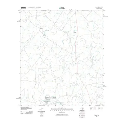
2010 Map of Warda
USGS Topo · Published 2010About this map
Northrup and Warda anchor this central Texas landscape, where the drainage patterns of Rabbs Creek and Pin Oak Creek define the local topography. This 2010 survey reveals a rural territory heavily shaped by small-scale water management, evidenced by the numerous named impoundments and dams. To the north, Walker Lake and Bamsch Lake sit near the primary roadways of FM 448 and FM 2239, while the southern reaches feature the numbered reservoirs of the Clear Lake Pines development, including Lake Number 6 and Lake Number 10.
Find a feature on this map
46 named features on this map. Tap any name to fly to it.
Don’t see what you’re looking for? This feature index may not catch every label — zoom into the map to look around manually.
Map Details
Editions of this 2010 Warda Map
This is the sole edition of this map. No revisions or reprints were ever made.
Other maps of this area

1885 · Bastrop
USGS Topo · 1:125,000

1893 · Bastrop
USGS Topo · 1:125,000

1901 · Flatonia
USGS Topo · 1:125,000

1904 · Bastrop
USGS Topo · 1:125,000

1919 · Giddings
USGS Topo · 1:62,500

1948 · Smithville
USGS Topo · 1:62,500

1950 · Smithville
USGS Topo · 1:62,500

1953 · Seguin
USGS Topo · 1:250,000

1954 · Austin
USGS Topo · 1:250,000

1956 · La Grange
USGS Topo · 1:62,500