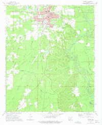
1973 Map of Warren
USGS Topo · Published 1975About this map
The timber and transit hub of Warren dominates this 1970s survey, where the Warren and Ouachita Valley rail line and the Missouri Pacific railroad converge near the city center. This industrial and civic core is detailed with the local Courthouse, Hospital, and several community schools including Bradley High School and Westside School. The surrounding landscape is defined by the winding Saline River to the east and a complex network of creeks like L'Aigle Creek and Henrys Creek to the west, which supported the local gravel and agricultural sectors.
Find a feature on this map
47 named features on this map. Tap any name to fly to it.
Don’t see what you’re looking for? This feature index may not catch every label — zoom into the map to look around manually.
Map Details
Editions of this 1973 Warren Map
2 editions found
Other maps of this area

1934 · Ingalls
USGS Topo · 1:48,000

1937 · Ingalls
USGS Topo · 1:62,500

1939 · Ingalls
USGS Topo · 1:62,500

1953 · Greenwood
USGS Topo · 1:250,000

1953 · El Dorado
USGS Topo · 1:250,000

1956 · Greenwood
USGS Topo · 1:250,000

1957 · El Dorado
USGS Topo · 1:250,000

1958 · El Dorado
USGS Topo · 1:250,000

1960 · El Dorado
USGS Topo · 1:250,000
1971 · Hermitage
USGS Topo · 1:24,000