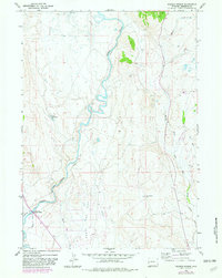
1966 Map of Warren Bridge
USGS Topo · Published 1982About this map
The Green River carves a winding path through this corner of Sublette County, defining the western topography as it flows toward the Narrows. In the mid-1960s, the landscape was a blend of natural waterways and intentional water management, visible in the extensive irrigation network of the Canyon Ditch and the proximity of the Franz Reservoir. Human activity is centered around the river and its tributaries, notably near the Horsefly Campground and the Gaging Sta Warren Bridge, a vital point for monitoring the basin's hydrology.
Find a feature on this map
16 named features on this map. Tap any name to fly to it.
Don’t see what you’re looking for? This feature index may not catch every label — zoom into the map to look around manually.
Map Details
Editions of this 1966 Warren Bridge Map
3 editions found
Other maps of this area

1907 · Gros Ventre
USGS Topo · 1:125,000

1909 · Fremont Peak
USGS Topo · 1:125,000

1910 · Gros Ventre
USGS Topo · 1:125,000

1939 · Big Piney
USGS Topo · 1:125,000

1942 · Big Piney
USGS Topo · 1:125,000

1955 · Driggs
USGS Topo · 1:250,000

1955 · Preston
USGS Topo · 1:250,000

1955 · Thermopolis
USGS Topo · 1:250,000

1955 · Lander
USGS Topo · 1:250,000

1958 · Driggs
USGS Topo · 1:250,000