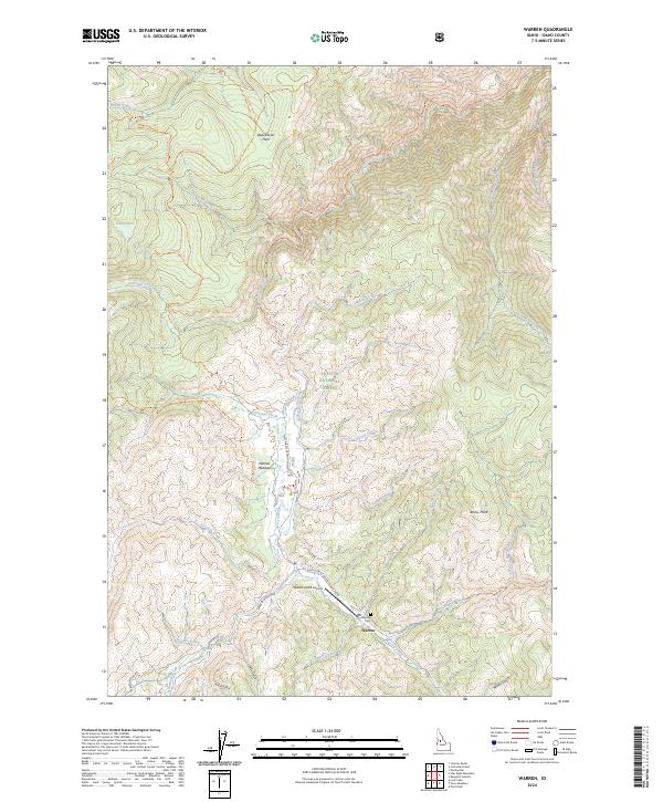
2024 Map of Warren
USGS Topo · Published 2024About this map
Warren serves as the central focal point of this Idaho County landscape, situated near the southern edge of the Payette National Forest. This high-elevation mining town is connected to the surrounding drainage systems by the Warren Wagon Rd and Natl Forest Develop Road 340 Rd. The map illustrates a complex network of creeks, including Warren Creek, Steamboat Creek, and Slaughter Creek, which have historically driven the area's placer and lode mining activity. Local history is anchored at the Warren Cem, while the Warren/USFS Airport provides modern access to this backcountry region. To the northeast, the terrain transitions into the Frank Church-River of No Return Wilderness, marked by distinctive features like Republican Flats and Bemis Point. The presence of numerous named gulches and flats, such as Arlise Gulch and Halls Gulch, suggests a landscape deeply shaped by early prospecting and settlement.
Find a feature on this map
52 named features on this map. Tap any name to fly to it.
Don’t see what you’re looking for? This feature index may not catch every label — zoom into the map to look around manually.
Map Details
Editions of this 2024 Warren Map
This is the sole edition of this map. No revisions or reprints were ever made.
Other maps of this area

1956 · Burgdorf
USGS Topo · 1:62,500

1956 · Warren
USGS Topo · 1:62,500

1956 · Elk City
USGS Topo · 1:250,000

1960 · Elk City
USGS Topo · 1:250,000

1969 · Loon Lake
USGS Topo · 1:24,000

1969 · Pony Meadows
USGS Topo · 1:24,000

1969 · Pilot Peak
USGS Topo · 1:24,000

1981 · Warren
USGS Topo · 1:100,000
1989 · Mackay Bar
USGS Topo · 1:24,000
1989 · Johnson Butte
USGS Topo · 1:24,000