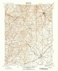
1927 Map of Warrenton
USGS Topo · Published 1961About this map
Fauquier Co and Culpeper Co are divided by the winding course of the Rappahannock River during this 1927 survey. The landscape is defined by its agrarian and resort character, notably the grounds of the Fauquier White Sulphur Springs situated along the river bend. To the northeast, the county seat of Warrenton serves as a major hub where several roads converge near Alwington. The survey captures a high density of rural institutions that once anchored these Piedmont communities, including numerous neighborhood schools like Piney Mtn Sch, Luttrell Sch, and Shade Sch.
Find a feature on this map
67 named features on this map. Tap any name to fly to it.
Don’t see what you’re looking for? This feature index may not catch every label — zoom into the map to look around manually.
Map Details
Editions of this 1927 Warrenton Map
4 editions found
Other maps of this area

1887 · Spottsylvania
USGS Topo · 1:125,000

1892 · Spottsylvania
USGS Topo · 1:125,000

1892 · Gordonsville
USGS Topo · 1:125,000

1893 · Luray
USGS Topo · 1:125,000

1894 · Warrenton
USGS Topo · 1:125,000

1894 · Warrenton
USGS Topo · 1:62,500

1905 · Luray
USGS Topo · 1:125,000

1927 · Remington
USGS Topo · 1:48,000

1930 · Warrenton
USGS Topo · 1:62,500

1933 · Middleburg
USGS Topo · 1:62,500