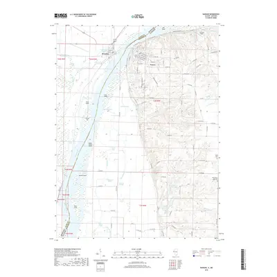
2018 Map of Warsaw
USGS Topo · Published 2018About this map
The Mississippi River forms the central artery of this region, separating Alexandria in Missouri from the city of Warsaw in Illinois. The map documents a complex aquatic landscape of side channels and wetlands, including Hemp Slough, Pickle House Slough, and Whitney Slough. Along the river’s main course, a chain of named features like Greys Island, Kamps-Stiens Island, and Willow Bar reveal the shifting hydrology of the border.
Find a feature on this map
109 named features on this map. Tap any name to fly to it.
Don’t see what you’re looking for? This feature index may not catch every label — zoom into the map to look around manually.
Map Details
Editions of this 2018 Warsaw Map
This is the sole edition of this map. No revisions or reprints were ever made.
Other maps of this area

1903 · Kahoka
USGS Topo · 1:125,000

1936 · Keokuk
USGS Topo · 1:62,500

1946 · Mendon
USGS Topo · 1:62,500

1948 · Mendon
USGS Topo · 1:62,500

1949 · Wayland
USGS Topo · 1:24,000

1949 · Kahoka SE
USGS Topo · 1:24,000

1950 · Kahoka SE
USGS Topo · 1:24,000

1950 · Wayland
USGS Topo · 1:24,000

1950 · Keokuk
USGS Topo · 1:62,500

1950 · Canton
USGS Topo · 1:24,000