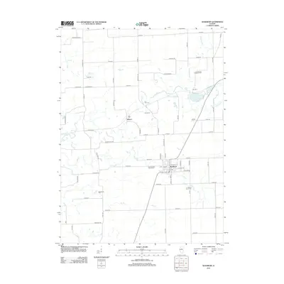
2012 Map of Washburn
USGS Topo · Published 2012About this map
Washburn and the smaller settlement of Wilbern anchor this portion of the Illinois prairie, characterized by a dense network of country roads and local drainage systems. The landscape is defined by the winding paths of Crow Cr and its tributaries, including Sherwoods Run and Snag Cr, which cut through the agricultural grid. This 2012 survey provides significant genealogical value, documenting numerous burial grounds scattered throughout the township. These include the Crow Meadow Presbyterian Cem in the northeast, Buckingham Cem to the southwest, and the Linn Mount Vernon Cem located south of the main town center. The map details the transition from rural acreage to the established street grid of Washburn, where Saint Elizabeth Catholic Cem and the Lutheran Cem are situated on the village periphery.
Find a feature on this map
69 named features on this map. Tap any name to fly to it.
Don’t see what you’re looking for? This feature index may not catch every label — zoom into the map to look around manually.
Map Details
Editions of this 2012 Washburn Map
This is the sole edition of this map. No revisions or reprints were ever made.
Other maps of this area

1893 · Lacon
USGS Topo · 1:62,500

1893 · Metamora
USGS Topo · 1:62,500

1933 · Lacon
USGS Topo · 1:62,500

1934 · Wenona
USGS Topo · 1:48,000

1937 · Metamora
USGS Topo · 1:62,500

1937 · Lacon
USGS Topo · 1:62,500

1939 · Wenona
USGS Topo · 1:62,500

1948 · Metamora
USGS Topo · 1:62,500

1955 · Minonk
USGS Topo · 1:62,500

1958 · Aurora
USGS Topo · 1:250,000