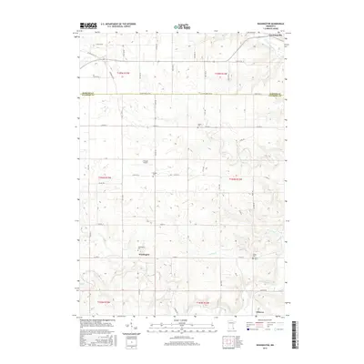
2016 Map of Washington
USGS Topo · Published 2016About this map
The rolling hills along the Olmsted and Fillmore line are defined by a network of creeks and the branches of the North Branch Root River. This rural landscape is anchored by the historic crossroads of Washington and Cummingsville, where the terrain drops into drainage basins for Bear Creek and Jordan Creek. The map provides significant value for genealogists and local historians, as it identifies several small, family-named burial grounds including Sodom Cemetery, Sumner Cemetery, and Baker Cemetery. While agriculture and small settlements dominate the region, the Flying A Airport stands out as a modern landmark in the township of t104n r13w. The intricate drainage patterns of Carson Creek and the Middle Branch Root River illustrate the hydrology that shaped this part of southeastern Minnesota.
Find a feature on this map
52 named features on this map. Tap any name to fly to it.
Don’t see what you’re looking for? This feature index may not catch every label — zoom into the map to look around manually.
Map Details
Editions of this 2016 Washington Map
This is the sole edition of this map. No revisions or reprints were ever made.
Other maps of this area

1954 · Chatfield
USGS Topo · 1:62,500

1954 · Mason City
USGS Topo · 1:250,000

1955 · Stewartville
USGS Topo · 1:62,500

1957 · Mason City
USGS Topo · 1:250,000

1958 · Mason City
USGS Topo · 1:250,000

1965 · Wykoff
USGS Topo · 1:24,000

1965 · Spring Valley
USGS Topo · 1:24,000

1965 · Fountain
USGS Topo · 1:24,000
1974 · Marion
USGS Topo · 1:24,000
1974 · Chatfield
USGS Topo · 1:24,000