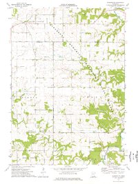
1974 Map of Washington
USGS Topo · Published 1976About this map
The Middle Branch Root River meanders through the southeast corner of this township, where the small settlement of Fillmore stands as a focal point for local history. This 1974 survey captures a landscape of managed timber and agriculture, dominated by the sprawling Minnesota Memorial Hardwood State Forest. The terrain is defined by a dense network of drainage, including Bear Creek, Jordan Creek, and Kedron Creek, which have carved deep valleys through the limestone bluffs characteristic of this region.
Find a feature on this map
29 named features on this map. Tap any name to fly to it.
Don’t see what you’re looking for? This feature index may not catch every label — zoom into the map to look around manually.
Map Details
Editions of this 1974 Washington Map
This is the sole edition of this map. No revisions or reprints were ever made.
Other maps of this area

1954 · Chatfield
USGS Topo · 1:62,500

1954 · Mason City
USGS Topo · 1:250,000

1955 · Stewartville
USGS Topo · 1:62,500

1957 · Mason City
USGS Topo · 1:250,000

1958 · Mason City
USGS Topo · 1:250,000

1965 · Wykoff
USGS Topo · 1:24,000

1965 · Spring Valley
USGS Topo · 1:24,000

1965 · Fountain
USGS Topo · 1:24,000
1974 · Marion
USGS Topo · 1:24,000
1974 · Chatfield
USGS Topo · 1:24,000