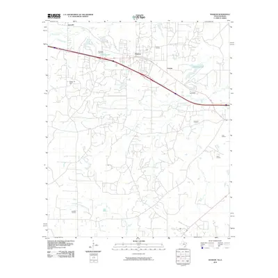
2010 Map of Waskom
USGS Topo · Published 2010About this map
Waskom sits at the center of this landscape, reflecting a region defined by the convergence of energy production and natural waterways. The Waskom Gas and Oil Field dominates the northwest, illustrating the industrial footprint on the local terrain near the border. Hydrological features such as Paw Paw Bayou and Big Sis Creek drain the area, while State Line Lake and Clearview Lake provide significant local landmarks, the latter managed by the Clearview Lake Dam. For those researching local heritage, the map is remarkably dense with burial sites, including Restland Cemetery, Forest Park Cemetery, Lester Cemetery, and the more specialized Park Rest Pet Cemetery. Smaller settlements like Lorraine and Jonesville are situated along the primary transportation corridors and bayous, marking the established communities of the early 21st century.
Find a feature on this map
18 named features on this map. Tap any name to fly to it.
Don’t see what you’re looking for? This feature index may not catch every label — zoom into the map to look around manually.
Map Details
Editions of this 2010 Waskom Map
This is the sole edition of this map. No revisions or reprints were ever made.
Other maps of this area

1943 · Waskom
USGS Topo · 1:62,500

1944 · Caddo Lake
USGS Topo · 1:62,500

1945 · Waskom
USGS Topo · 1:62,500

1945 · Greenwood
USGS Topo · 1:62,500

1946 · Caddo Lake
USGS Topo · 1:62,500

1948 · Mooringsport
USGS Topo · 1:62,500

1955 · Shreveport
USGS Topo · 1:250,000

1955 · Mooringsport
USGS Topo · 1:62,500

1955 · Greenwood
USGS Topo · 1:62,500

1956 · Shreveport
USGS Topo · 1:250,000