
1965 Map of Wasson
USGS Topo · Published 1968About this map
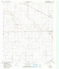
Running Water Draw carves a winding path through the High Plains of Hale County, creating a topographically complex corridor in an otherwise flat agricultural landscape. In the mid-1960s, this area north of the Plainview city center was a hub of industrial activity tied to the region's agricultural roots and emerging energy infrastructure. The map reveals a network of essential resources, including a Chemical Plant and a Radio Tower near the community of Wasson, while the presence of the Heck Cotton Gin and West Side Cotton Gin underscores the local economic reliance on fiber production.
Find a feature on this map
16 named features on this map. Tap any name to fly to it.
Don’t see what you’re looking for? This feature index may not catch every label — zoom into the map to look around manually.
Map Details
Editions of this 1965 Wasson Map
2 editions found
Other maps of this area

1954 · Plainview
USGS Topo · 1:250,000

1958 · Plainview
USGS Topo · 1:250,000

1965 · Kress West
USGS Topo · 1:24,000

1965 · Edmonson
USGS Topo · 1:24,000

1965 · Plainview
USGS Topo · 1:24,000

1968 · Halfway
USGS Topo · 1:24,000

1968 · Happy Union
USGS Topo · 1:24,000
1968 · Hale Center SW
USGS Topo · 1:24,000
1968 · Hale Center
USGS Topo · 1:24,000

1969 · Kress East
USGS Topo · 1:24,000